

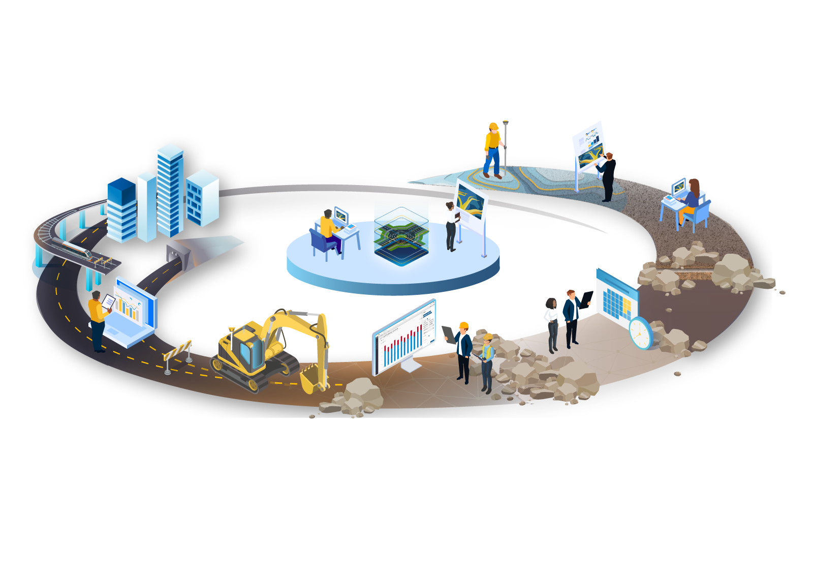
Trimble Connected Construction
From concept to onsite operations, our construction software solutions connect each lifecycle phase of your civil construction projects. Click on the graphic below to learn more.
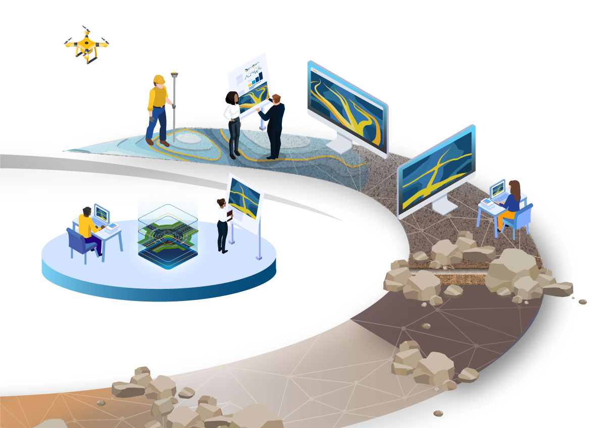
Concept and Design
Before a shovel even hits the ground, it is typical for a project to go through a planning and feasibility phase or assessment. This helps determine the best use of the area being developed based on project goals, budget, local codes, regulations, and economic viability. Once the project is approved, a detailed topographic survey is conducted and a set of plans that depict the objects to be constructed are presented.
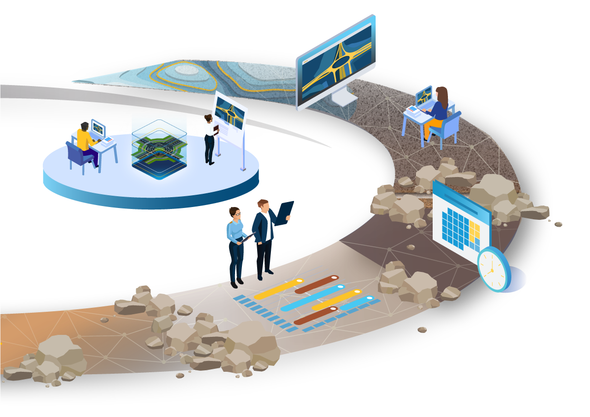
Schedule and Project Management
Once the bid is accepted, the scheduling and project management phase begins. Typically, this kicks off the project and schedule planning to determine the time, costs, and resources involved in completing the project. This includes planning and machine, people, and aggregate management.
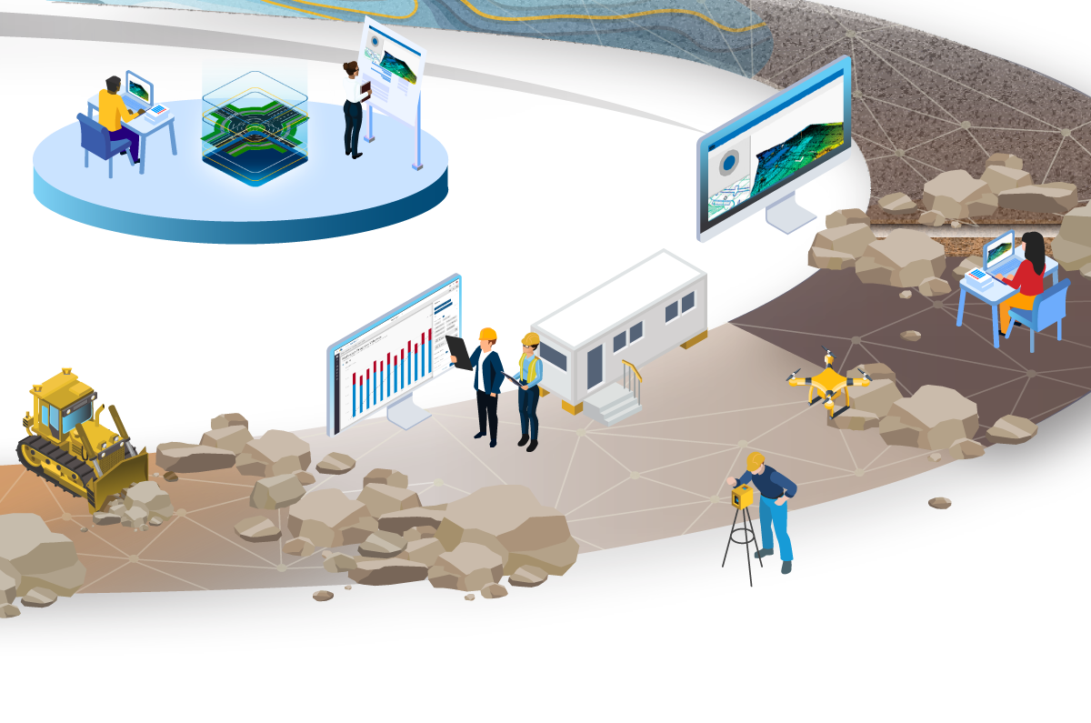
Construct and Build
As the project moves into the construct and build phase the site survey data is collected and shared over the cloud to the machines in the field. That takeoff information is then relayed to a productivity solution to being tracking jobsite data in real-time.
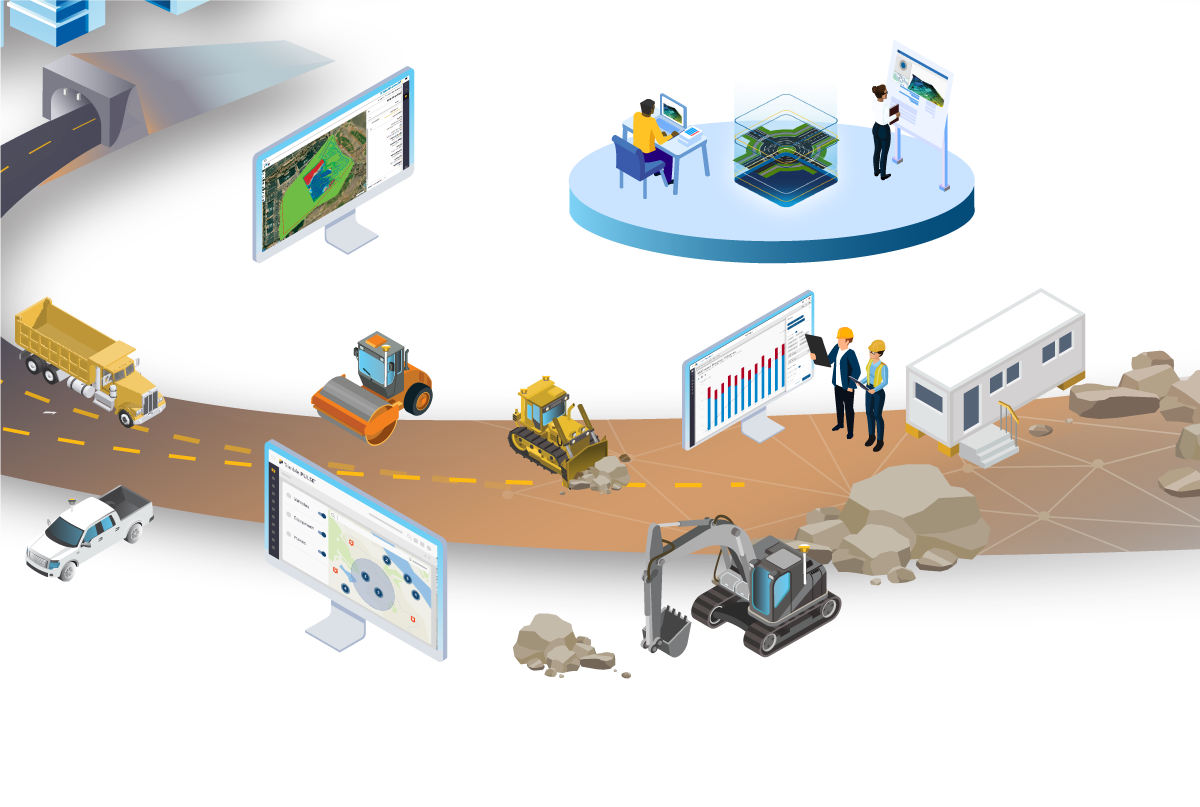
Construct and Build
Operations management is the bridge between takeoff to jobsite productivity, with the 3D productivity solution connecting the data from takeoff to machine control data into one dashboard. Also in this phase, asset management becomes important with the ability to establish geofences and track the utilization of on-highway and off-way equipment.
Operate and Maintain
Once the project is moving along, it enters the operate and maintain phase. At this point in the project collaboration, productivity, and cost control are the most important data points. If changes occur in the design, that is communicated within a central data hub so that all machines and people are working from the newest model. Meanwhile, productivity is tracked, recorded, and easily communicated with final volumes and pass counts to provide proof of work at any point.
In a constantly evolving technology era, it’s crucial for construction companies to streamline their processes towards a more efficient tomorrow. Construction productivity is a broad, but important concept that encompasses the many steps it takes to complete a project on time and within budget.
Throughout a project lifecycle there are many moving parts and managing all of those different elements is crucial for success. With Trimble’s comprehensive software solutions, you can effectively achieve a connected construction lifecycle. Solution integrations make your construction workflows quicker and smarter, who doesn’t want that?

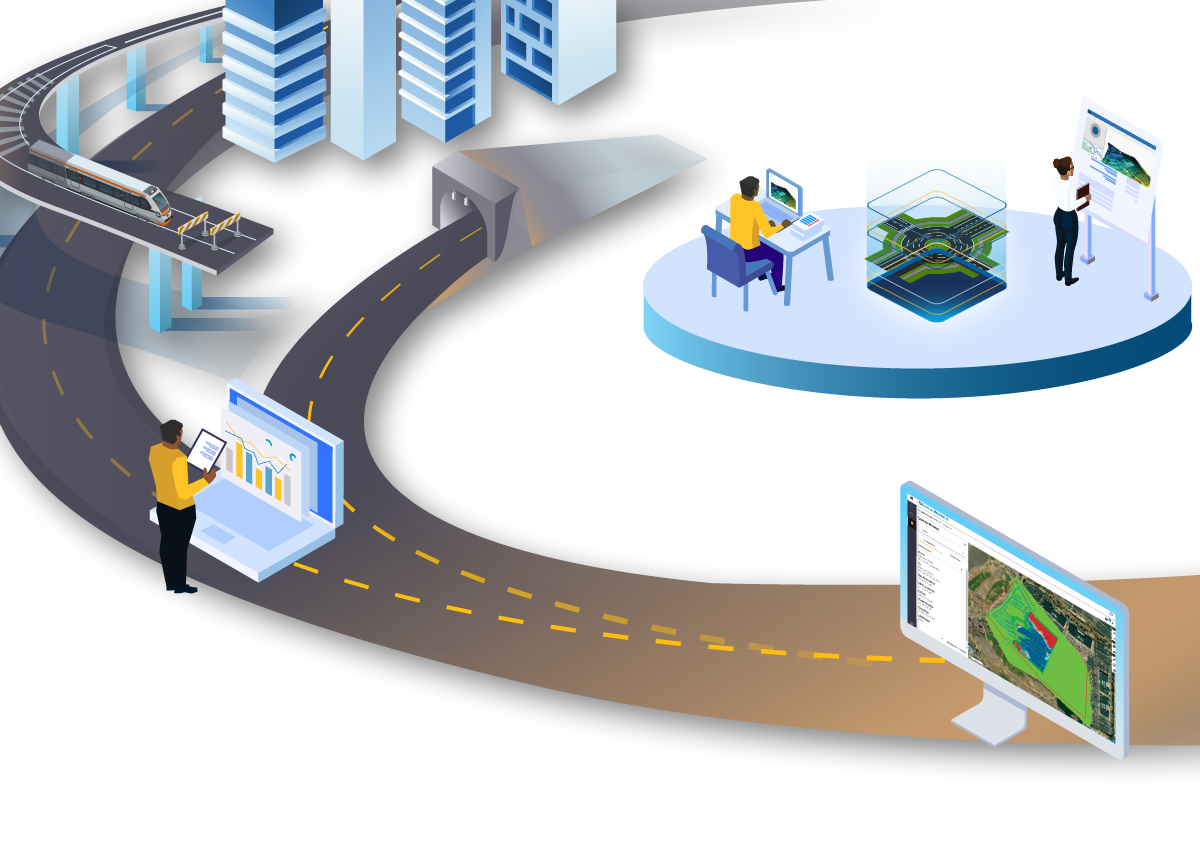
Concept, Design and Planning
The concept and design phase of a project plays an important role in the connected construction lifecycle by influencing productivity in subsequent phases. Before any construction begins, assessing the feasibility of the project will build the proper foundation for project success.
At this point of a construction project you may find yourself struggling to automate planning processes. Whether you’re wanting to integrate a feasibility study with the detailed design process, or seeking faster validation and comparison of a road corridor with more information; it’s crucial to optimize these processes.
Through this phase of a project, technology has the potential to drastically improve productivity within construction operations management. This includes:
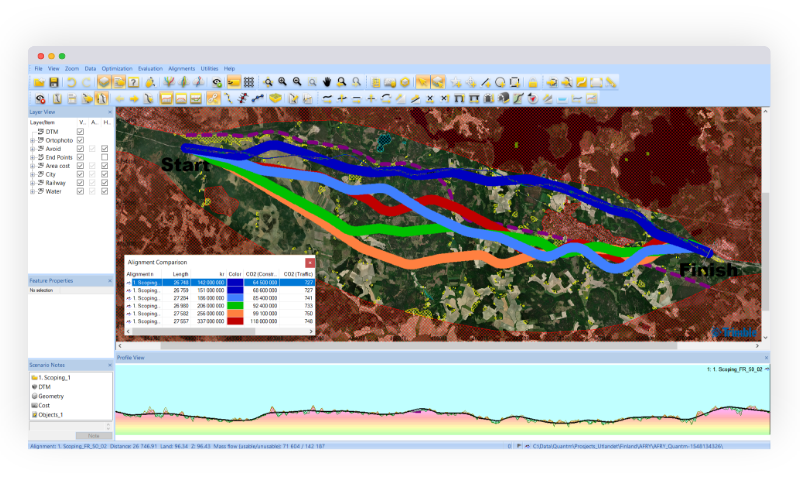
- Feasibility Plan: Finding and evaluating all construction alignment alternatives allows you to create the most efficient plan for your project. Our advanced construction software, Trimble Quantm includes feasibility planning tools to help engineers define and optimize corridors and alignments from A to B.
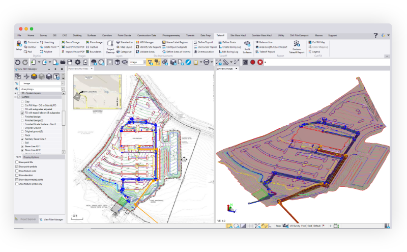
- 3D Design Model: With Trimble Novapoint 3D construction design software you have the ability to handle complex, multi domain projects with 3D terrain surfaces, 3D subsurface layers and 3D structures of roads.
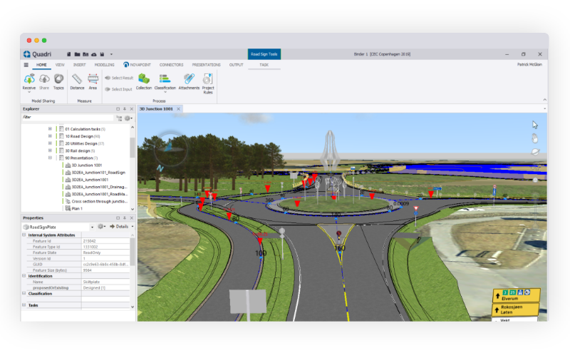
- BIM Collaboration: BIM allows the sharing of data between multiple users with different disciplines; enabling a tight collaboration between all stakeholders. During the design and planning phase, this is crucial for success. With Trimble Quadri civil BIM software, you have access to all models within one central location.
After successfully completing the planning and design phase, it’s time for scheduling and project management plans.

Schedule & Project Management
Once the contractor has been awarded a project, the project management phase begins. With a connected construction concept in mind, having the ability to access project information in one central location can make or break a project schedule.
Within this phase of a project, it’s common for nuances around equipment and resources spread across a large construction area to arise. Without the ability to access time-location planning of assets and resources, you may easily fall behind schedule.
Thanks to technology, you can schedule and monitor jobsite activity and planning with tools that encompass:
- Scheduling: Trimble Tilos linear scheduling software provides one central software tool to plan and manage linear construction projects.
- Estimating: Trimble Quest is a robust cost estimating software that allows contractors to manage construction cost estimates with real world accuracy.

Construct & Build
The construct and build phase requires extreme attention to detail with centralized communication. Between operations and asset management, it’s crucial to have access to one unified dashboard that enables complete and real-time visibility into jobsite progress.
At this juncture, you may be struggling to accurately calculate the productivity of each construction asset and associate it to direct project costs. Not only that, but when it comes to saving costs, many contractors don’t have the ability to easily track work completed vs. work remaining. If this sounds familiar, you have an opportunity to drastically improve construction productivity.
Trimble technology supports many requirements in this phase including:
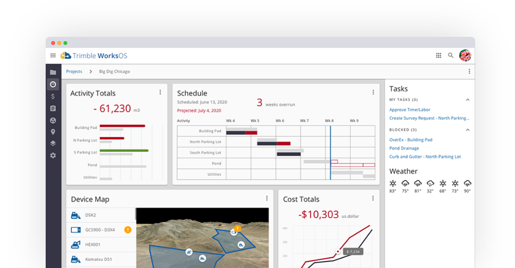
- Jobsite Management: Trimble WorksOS is a cloud-based jobsite productivity software and operating system that delivers 3D productivity and real-time progress to plan for site supervisors and project managers to maximize jobsite efficiency. Shared data from WorksOS ensures all project contributors have the latest information to empower their decisions and become more productive.
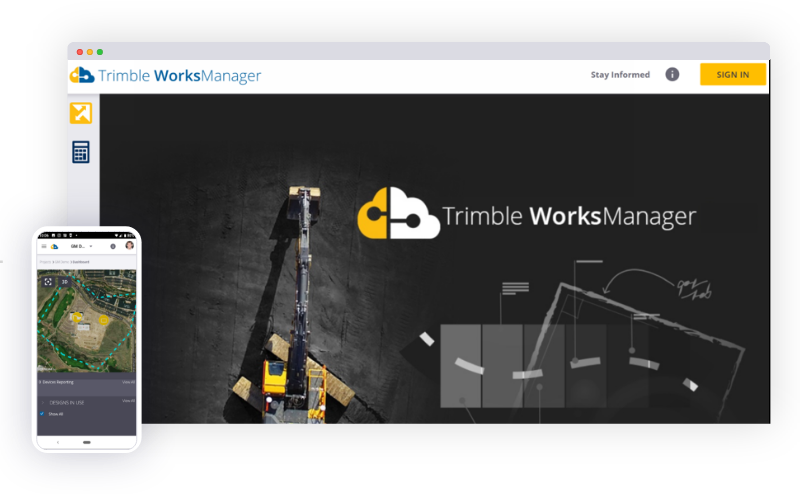
- Manage Design Data: Once the work begins on the jobsite, it’s continuously important to access critical project data. With Trimble WorksManager, you can limit the risk of miscommunication to and from the field with automatic data transferring with our data management software.

Operate & Maintain
After project completion, the site is turned over to the owner and transitions into an operation and maintenance phase. For all projects, but especially capital improvement ones like roads and highways, the owners will need to regularly inspect and repair items that become damaged with frequent usage.
Collaboration and understanding of the operation and maintenance of civil construction projects can be a challenge after the project is complete. If there is no clear data available, it will be nearly impossible to accurately and safely maintain structures. Technology that supports these aspects includes:
- Continuous Mapping: Trimble Business Center construction data prep software allows for constant mapping, documentation and analysis of a structure.
- Structure Support: Throughout a project, the data is constantly being imported and updated to the model. In this phase, the tracking and documentation of the project can be used to maintain and support the use of the structure with Trimble Quadri.
3D Design Modeling
Efficiently design complex 3D models of infrastructure projects
Learn More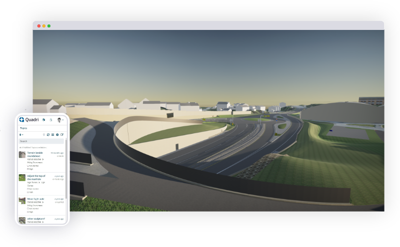
Takeoff & Site Modeling
Create and manage accurate construction models for takeoff
Learn More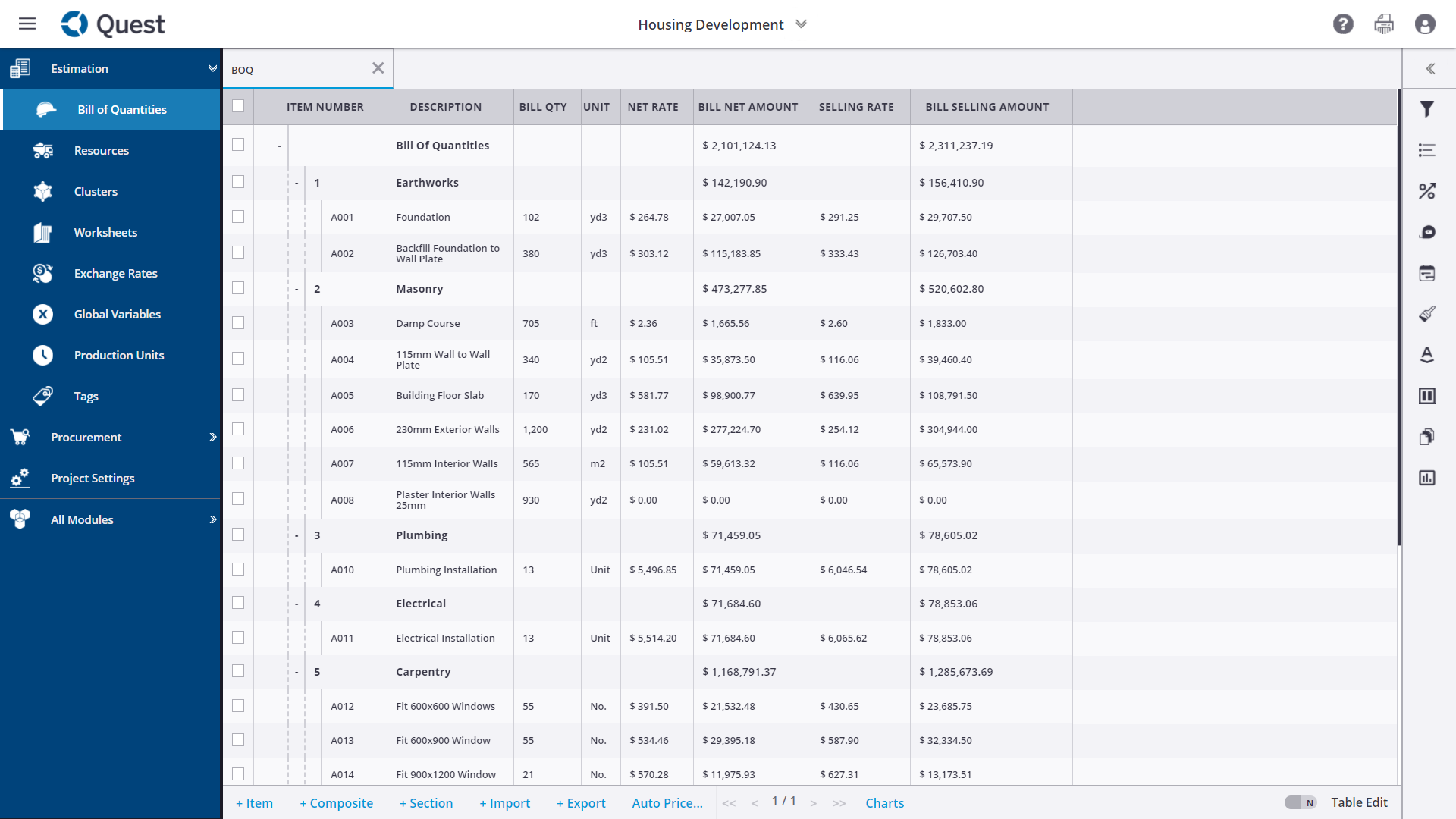
Cost Estimating
Rapidly produce estimates and bids, and manage budgets during construction project
Cost Estimating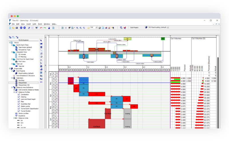
Design Management
Transfer and send real-time, updated jobsite design information
Learn More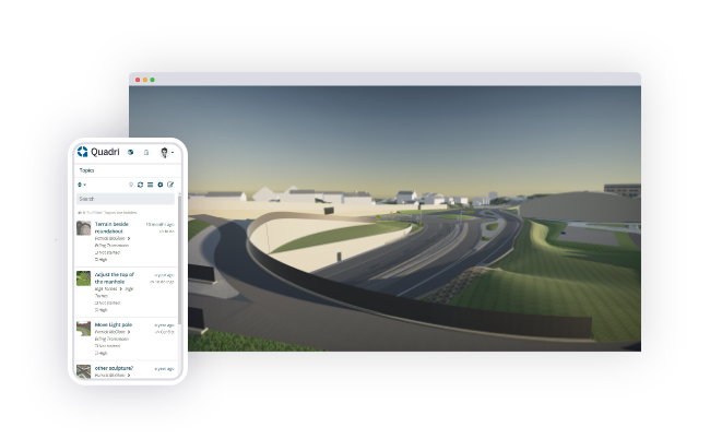
Meet Quadri
As designed. As built. As expected. Using one model throughout the construction project is possible for all stakeholders. Collaborate on an infrastructure project in real time with Trimble’s proven civil BIM collaboration solution.
Find out moreFeatured Construction Software News